Dein Marathon-Traum startet hier! Laufe zu den modernen und klassischen Highlights von Wien und feiere deinen Zieleinlauf im Herzen der Stadt.
Anstrengung, Stolz, Glück: Erlebe alle Emotionen und die eindrucksvolle Wiener Szenerie auf der halben Marathondistanz.
Teile die Strecke, vergrößere die Freude. Spüre den Teamspirit in der Staffel gemeinsam mit Familie, Freund*innen und Kolleg*innen.
Laufen, gehen, walken: Einmal auf der Ringstraße um die Innenstadt. „Bewegung für alle“ auf Wiens historischem Pracht-Boulevard.
Schnelle Füße, großer Einsatz: Kinder und Jugendliche erleben die Freude am Laufen und den Spaß am Wettbewerb.
Start frei für die Jüngsten! Mitreißende Stimmung auf der kürzesten Laufdistanz. Hier schlagen die Herzen besonders hoch.
„Miteinand“ und ohne Barrieren! Der Coca-Cola Inclusion Run steht für Gemeinschaft, Inklusion und pure Freude an der Bewegung.
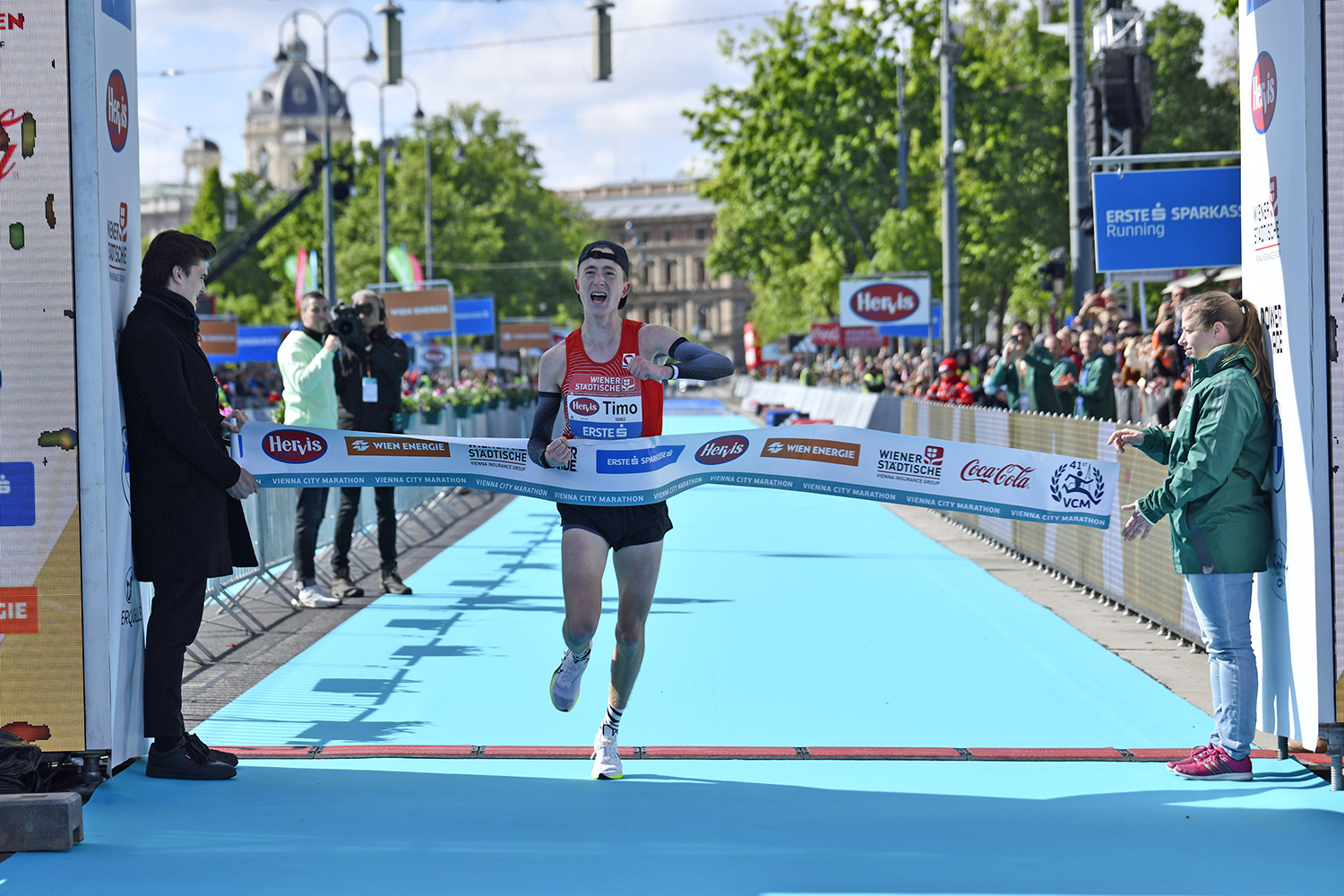
21. April 24
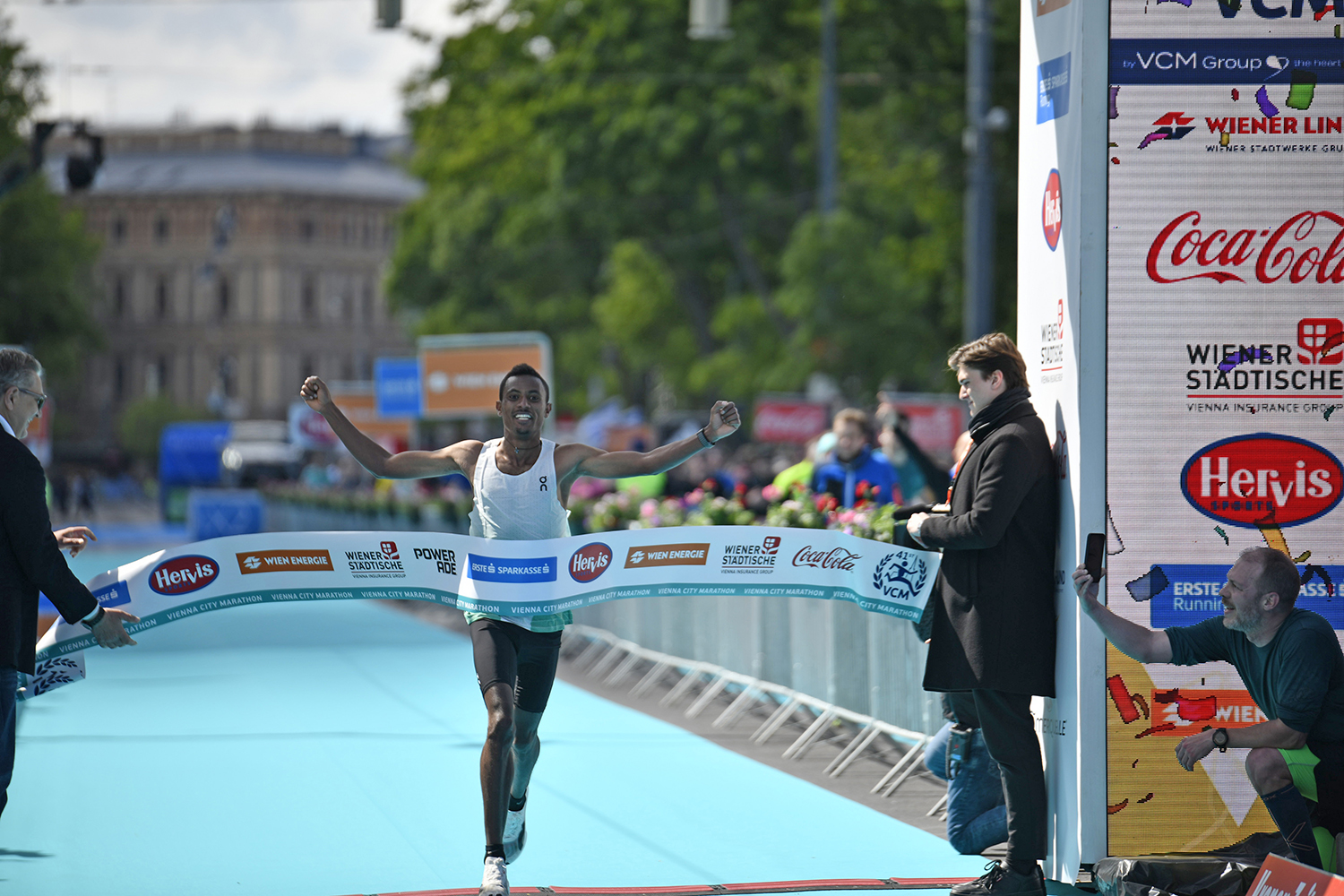
Chala-Regasa-Show beim Vienna City Marathon
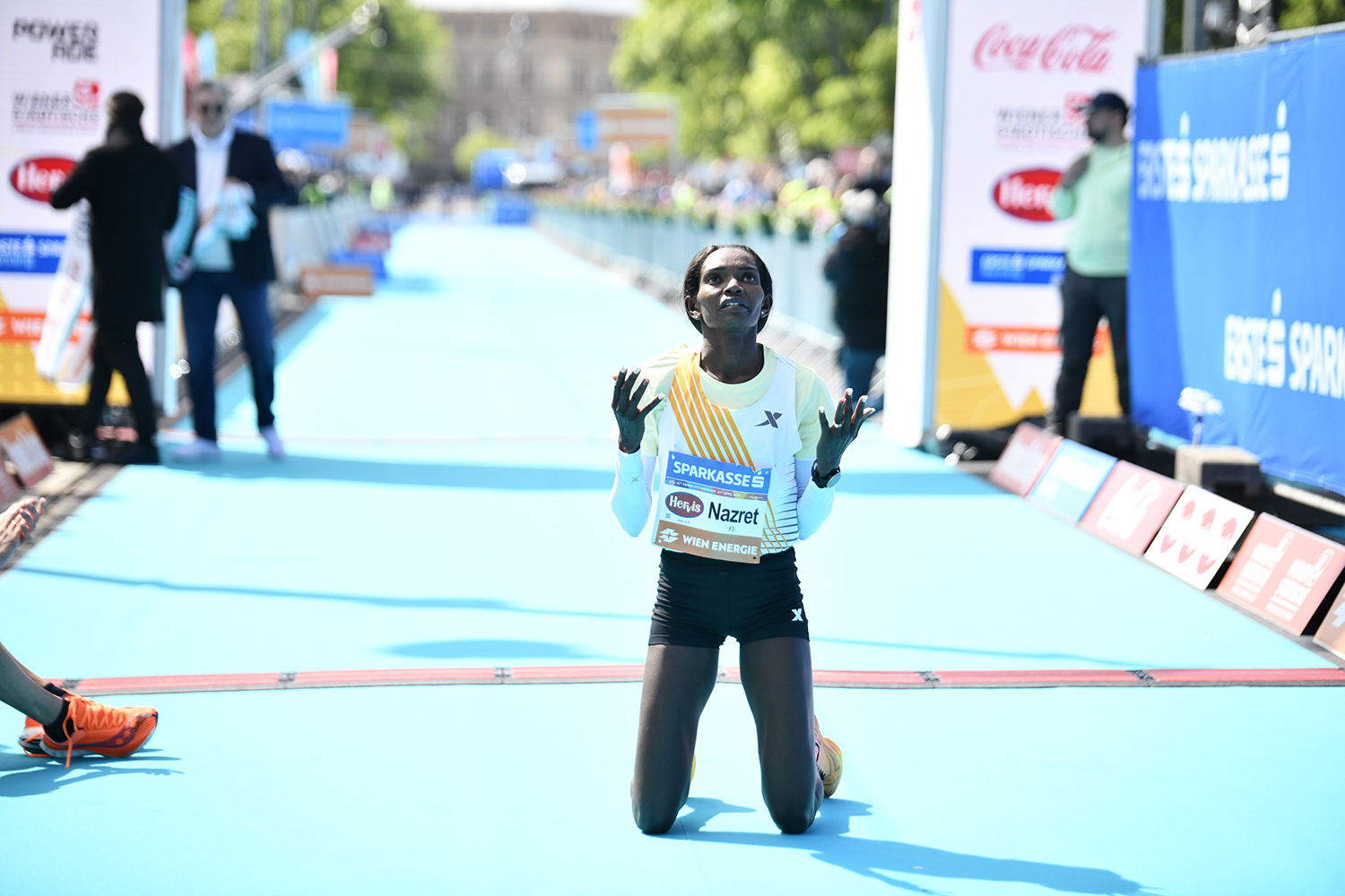
Rookie-Läuferin zeigt auf Platz zwei auf
Die Rekordläuferin trotzt auf Rang 10 ihren Hormonen
Shirts, Caps & mehr – Alles, was du für deinen Lauf brauchst, findest du in unserem VCM Online Shop!
VCM Online Shop öffnen
21. April 2024
Bunt, klassisch, unvergesslich:Danke an alle Läufer*innen, Helfer*innen & Fans!
Vienna is one of the most amazing running cities in the world. The marathon is perfectly organized and the route is a string of highlights.
UK
Das Lauf-Highlight im eigenen Land mit Top-Stimmung. Da will man einfach dabei sein!
Österreich
Der VCM bietet Bewerbe für meine gesamte Familie. So konnten wir alle Wien laufend erleben!
Deutschland
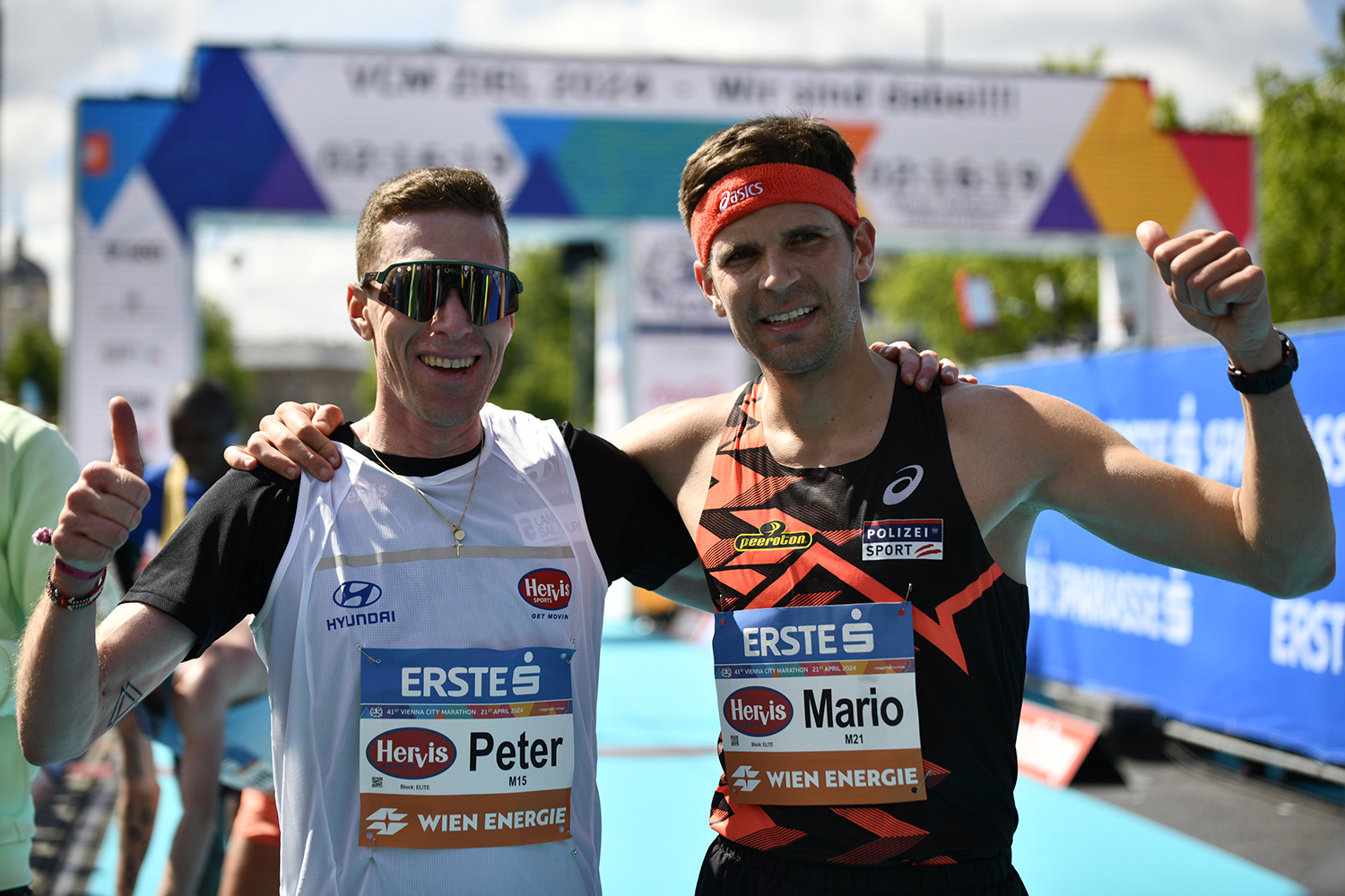
Schlagabtausch im Prater: Peter Herzog mit erfreulichem Marathon-Comeback
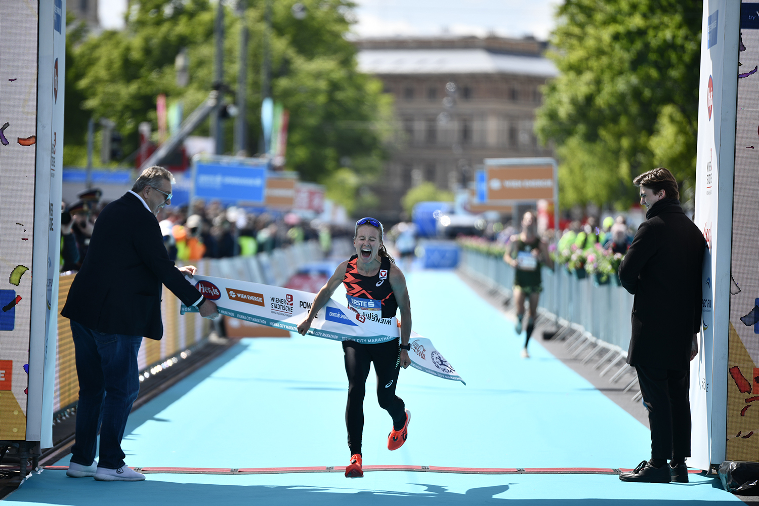
Sieg mit neuem ÖLV-U23-Rekord – Melissa Hawtin jubelt als schnellste Frau
Die klassische Wiener Ringrunde mit über 3.300 gemeldeten Teilnehmer*innen